कसलेल्या डोंगरयात्रींची कठीण परीक्षा शिरपुंजे जवळचा भैरवगड
महाराष्ट्रात ४ भैरवगड आहेत पण अहमदनगर जिल्ह्यात अकोले तालुक्यात हरिश्चंद्रगडा समोर मुळा नदीच्या खोर्यात शिरपुंजे आणि कुमशेत या गावांमध्ये असलेल्या भैरवगड मध्ये कसलेल्या दुर्गयात्रींना अगदी कठीण परिश्रम करायला लावणारा आणि त्या परिश्रमाचे फळ म्हणजे भैरवगड तुम्हाला त्याचा माथ्यावरून कळसुबाई पासून ते हरिश्चंद्रगड-माळशेज-नाणे घाट -भीमाशंकर पर्यंन्तचे अवाढव्य सह्याद्रीचे एक बुलंद रूपाचे दर्शन घडवतो
जायचे कसे
शिवाजीनगर पुण्याहून अकोले गावाला जाणार्या कोणत्याही S T बस ने राजूरला उतरावे व तेथून अंबित गावी जाणारी s t पकडावी आणि शिरपुंजे गावी पायउतार व्हावे .
स्वतःचे वाहन असेल तर उत्तम कारण एस टी आणि जीप ची सेवा या भागात फार कमी आहे
रस्त्याच्या कडेला असलेल्या शाळेच्या इमारतीपासून पासून शेतांमधून जाणारी पायवाटेने २ कि मी चालून नंतर एक वाट डावीकडे वरती जायला लागते एक रस्ता भैरोबा (या गावात फक्त भैरोबा चा डोंगरावर कसे जायचे हे विचारावे ) आणि दुसरा रस्ता घनचक्कर(१५३२ मिटर) या महाराष्ट्रातील तिसर्या क्रमांकाचे उंचीचे डोंगलाला एक वाट जाते (भैरवगड आणि घनचक्कर डोंगर जोडून असलेले डोंगर आहेत पण भैरव गडावरून घनचक्कर ला जायला वाट नाही. दोन डोंगरांना एका खिंडने विभागले आहे .जर तुम्हाला घनचक्कर वरती जायचे असेल तर भैरवगड पूर्ण उतरून शिरपुंजे गावात परत यायला पाहिजे आणि शिरपुंजे वाडीतून घनचक्कर चा एक उतरणारा दांड चढून पठारावर जायला लागते.घनचक्कर हा एक चमत्कारी डोंगर आहे कारण हा डोंगर एवढा पसरला आहे आणि त्याला इतके दांड आहेत कि तुम्हाला हा डोंगर कोठून कुठे पोहोचवेल याचा नेम नाही म्हणजे या डोंगरावरून तुम्ही भांडारदारा ला सुद्धा जाऊ शकता,हरिश्चंद्रगड ला सुद्धा जाऊ शकता,कुमशेत मार्गे कोकणात पण उतरू शकता,रतनगड-हरिश्चंद्रगड ट्रेक करणार्यांना तर हा घनचक्कर मुदा चा डोंगर पार करावा लागतोच आणि त्यामुळेच या डोंगरावर सहसा कोणी डोंगरयात्री फिरकत सुद्धा नाही कारण जर वाटसरू नसेल तर कोणताही डोंगर यात्री घनचक्कर वर सहज हरवून जाईल म्हणून या डोंगराच्या ट्रेक ला यायचे असेल तर स्वतःचे वाहन आणू नये म्हणजे तुम्ही जेथून चढले आहात त्याच गावात उतरण्याची काळजी राहत नाही .घनचक्करच्या पठारावरून रतनगड ३ तासाच्या अंतरावर आहे पण हि फार बिकट वाट आहे )
भैरवगड पण उंची बाबत घनचक्कर पेक्षा अंदाजे ३०० मिटर ने कमी असेल म्हणजे सिंहगड एवढी उंची या गडाला आहे म्हणून या गडावर हवा नेहमी थंड राहते
भैरवगडाची उंची हि साधारण १२५०-१३०० मी इतकी असावी असा अंदाज आहे (शेजारच्या १५३२ मीटर्स उंचीच्या घनचक्कर डोंगर बरोबर तुलना केली तर तुम्ही हि माहिती अंदाजे सांगू शकता कारण या भैरवगड डोंगराच्या उंची बद्दल कोठलीच माहिती उपलब्ध नाही )
आता शिरपुंजे गावातील घरे सुरु झाल्यावर डावीकडील वरती जाणारी वाट धरावी हीच भैरवगडची रुळलेली वाट.
वाट हि कायम दाट झाडीतून आणि कारवीच्या रानातून असल्यामुळे उन्हाचा विशेष त्रास होत नाही (हा भाग कळसुबाई हरिश्चंद्रगड अभय अरण्यात येत असल्यामुळे येथे बेहडा ,जांभूळ , हिरडा , आवळा , जंगली लिंबू ,करवंद इत्यादींचे झाडी फार मोठ्या प्रमाणात आढळतात तसेच वन्य प्राण्यांमध्ये पांढर्या रंगाचे वानर सहज दिसते पण या भागात बिबटे दिसणे म्हणजे दुर्मिळ गोष्ट कारण जरी दाट झाडी आहेत पण बिबट्या साठी भक्ष फार कमी प्रमाणात उपलब्ध असल्यामुळे येथे बिबटे सहसा दिसत नाहीत पण सर्प जातीतील अजगर या भागात सापडल्याची नोंद आहे असे स्थानिक ग्रामस्थ सांगत )
मध्ये काही शेती लागतील आणि काही वेळानंतर एक कमान लागेल आणि त्या कमानीतून तुम्हाला भैरवगडाच्या पायऱ्या दिसतील आणि इथूनच एक खडी चढण सुरु होते ती अगदी शेवटच्या टोका पर्यंत कायम राहते
भैरवगड शिरपुंजे गावातून साधारण ५०० मिटर उंचावलेला आहे आणि हि सगळी चढण खडी आहे .या चढण मध्ये कोठेही पठार लागत नाही (जो पर्यंत तुम्ही माथ्यावर पोहोचत नाही तोपर्यंत )
गडाचा माथा गाठायला साधारण १.५ तास लागतात (म्हणजे शिरपुंजे गावातील शाळेपासूनचे २ कि मी पायी चालणे पकडून )
नागमोडी जाणारी वाट हि शेवटच्या कातळ टप्प्यात भैरवगड - घनचक्कर मधील खिंडीत येऊन पोहोचते . हि शेवटची चढण थोडी अवघड आहे आणि नवख्या डोंगर यात्रींच्या साठी तर हे एक आव्हानच असेल जवळ जवळ सरळ उभ्या कातळातून जाणारी हि वाट आहे . पण कमीत कमी १० -१२ किल्ले डोंगर चढल्याचा अनुभव असेल तर हि खिंड पार करायला फार थोडे परिश्रम करायला लागतात (हो पण परिश्रम करावे लागतात हे खर )
हि खिंड पार केली कि शेवटच्या कातळ टप्प्यात दगडात कोरलेल्या पायऱ्या लागतात आणि थोड्याच वेळात गडाच्या टोकावर आपला प्रवेश होतो
गडावर विशेष काही तटबंदी नाही पण येथे गुहेत एक भैरोबाचे पुरातन देउळ आहे आणि राहण्यास एक गुहा आहे अगदी ८-१० माणसे राहू शकतील एवढी
आणि पाण्याच्या टाक्या भरपूर आहेत पण पिण्यायोग्य पाणी फक्त एका टाकीत आहे
माथ्यावरून चौफेर नजर टाकली तर कळसुबाई शिखरापासून ते नाणे घाट पर्यंत तुम्हाला स्पष्ट डोंगररांग दिसेल
म्हणजे या गडाचा उपयोग हा पूर्ण मुळा नदी खोरे,माळशेज नाणे घाट आणि प्रवरा नदीचे खोरे या विस्तीर्ण प्रदेशावर लक्ष ठेवायला वापरत असणार यात काहीच शंका नसेल
इतिहासत या गडाचे शिवाजी महाराजांबरोबर संबंध आहेत म्हणजे १६७३ च्या सूरत च्या लुटी नंतर महाराज हरिश्चंद्रगडाच्या शेजारी असणाऱ्या कोंबड किल्ला / कुंजर गडावर काही काल राहिले होते आणि असा अंदाज आहे कि महाराजांनी या गडावरून कुंजरगडा कडे प्रयाण केले म्हणजे अगदी थोडा वेळ महाराज या गडावर आले होते आणि तिथून नाणे घाट जीवधन मार्गे खाली रायगड पर्यंत पोहोचले .
इतिहासात शिवाजी महाराज आणि भैरवगड याचे एवेढेच संबंध आहेत अगदी थोडा काळ का होईना पण छत्रपतींच्या पदस्पर्शाने पुनीत झालेली हि भूमी आहे
पण या वरून एवेढे लक्षात येईल कि त्यावेळी इथे तटबंदी असली पाहिजे .आता फक्त थोडे भग्न अवशेष दिसतात
किल्ल्यावर सपाट जागा आहेत पण तटबंदीचे थोडेफार अवशेषच सापडतात
पण हल्ली हा दुर्ग भैरोबा दुर्ग म्हणून ओळखला जातो तो भैरवनाथाचे देवस्थानामुळे
भैरवगडावर एक पुरातन गुहा आहे आणि त्यामध्ये घोड्यावर स्वार भैरवनाथाची वेगवेगळ्या रंगात रंगवलेली एक सुंदर मूर्ती आहे आणि दगडी दिपमाळ तुम्हाला या गुहेत दिसतील.
शेजारीच राहण्यासाठी एक गुहा आहे ,गुहेत एक चूल सुद्धा आहे आणि इथल्या लोकांनी त्या गुहेत भांडी सुद्धा ठेवलीत म्हणजे ट्रेक साठी येणाऱ्या लोकांची ची जेवण बनवण्याची व राहण्याची सोय करून ठेवली आहे
वास्तविक मला भैरवगडावरून खिंडीतून घनचक्कर चा ट्रेक करायचा होता पण खिंडीमधून घनचक्कर वरती जाण्यास कोणताही मार्ग उपलब्ध नाही.आधी सांगितलेल्या प्रमाणे पुन्हा तुम्हाला शिरपुंजे गावात खाली उतरून पुन्हा घनचक्करच्या शिरपुंजे गावात उतरणाऱ्या सोंडेवरून २ तासात घनचक्कर गाठता येतो आणि मला भैरवगड उतरायला ४:३० झालेले होते म्हणून घनचक्कर या वेळेस करू नाही शकलो पुढच्या वेळेस कधी आलो इकडे तर करेल. २ तास तर लागतात घनचक्कर चढायला(महाराष्ट्रातील तिसर्या क्रमांकाच्या उंचीचे हे डोंगर हे डोंगरयात्रींनी जरूर करावे असाच आहे आणि मुख्य म्हणजे कोणाला माहित नसलेले डोंगर चढण्याचा आणि त्या बद्दल माहिती प्रकाशित करण्याचा आनंद काही वेगळाच असतो)
शिरपुंजे गावातला एक माणूस घनचक्कर साठी गाईड बनायला तयार झालाय आता बघू कधी घनचक्कर-मुडा डोंगराचा चा मुहूर्त लागतो ते .
काही फोटो खाली दिलेला आहेत
भैरवगडावरून दिसणारी कळसुबाई ची रांग


भैरोबा देवस्थान


भैरवगडावरची गुहा

या कमानीतून भैरवगडा कडे जाण्याचा मार्ग आहे

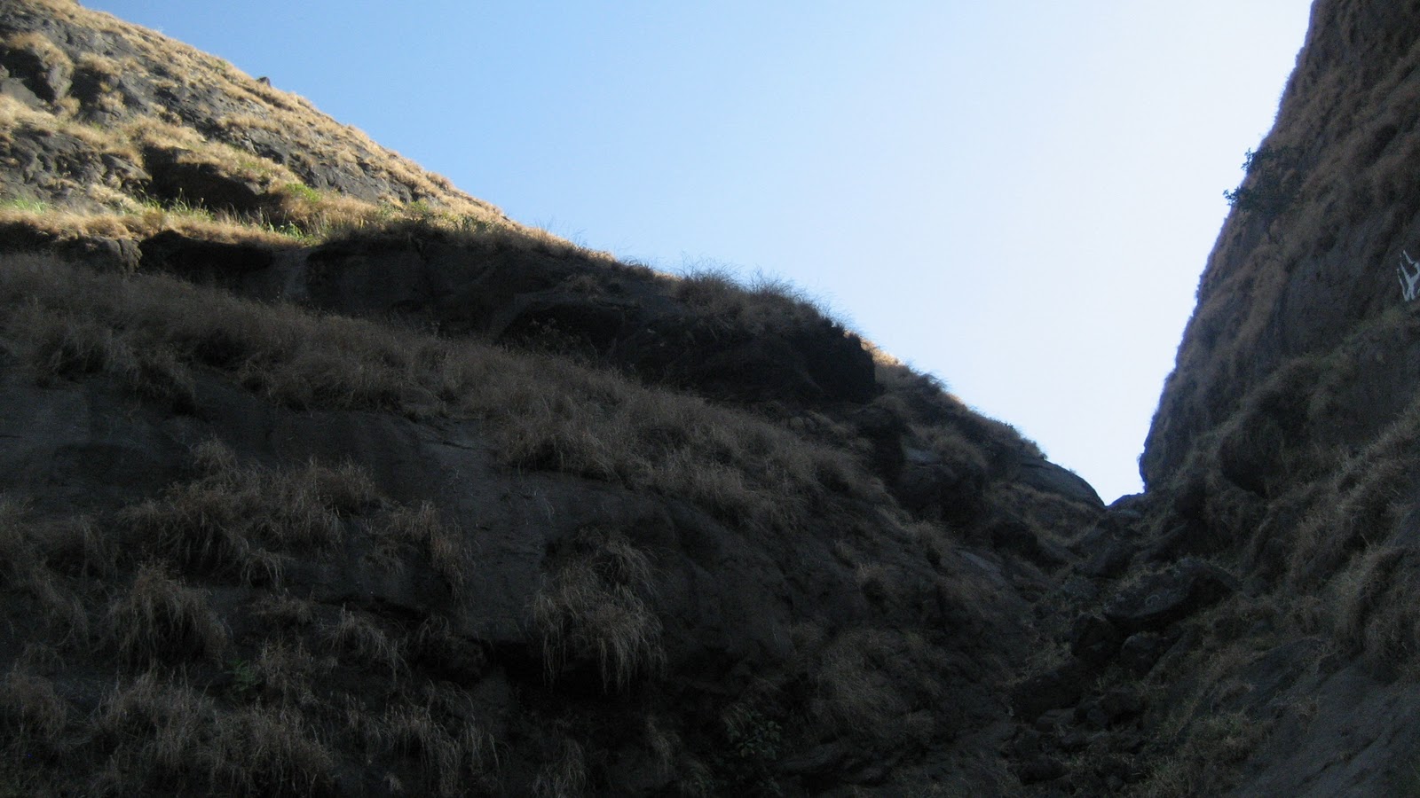
भैरवगड घनचक्कर मधील खिंड .शेवटची चढण चढून डावीकडे भैरव गडाचा माथा आहे

महाराष्ट्रातील तिसर्या क्रमांकाच्या उंचीचे डोंगर घनचक्कर(१५३२ मीटर्स ) आणि त्याचे विस्तीर्ण पठार(भैरव गडाच्या माथ्यावरून )

शिरपुंजे गावातून दिसणारे घनचक्कर चे डोंगर

भैरव गडावरून दिसणारे घनचक्कर चे शिखर


 भैरवगड ची खिंड खडी चढण असलेली वाट


शिरपुंजे गावातून दिसणारा भैरवगड

भैरवनाथाच्या मंदिराजवळ

 कुमशेत, नाणे घाट,साढले घाट इत्यादी चे दृश्य भैरव गडाच्या माथ्यावरून

 भैरवगडावरून दिसणारा हरिश्चंद्रगड आणि कुंजर गड(कोंबड किल्ला )

शिरपुंजे गावातून दिसणारा भैरवगड (डावीकडे ) आणि घनचक्कर (उजवीकडे )

भैरवगड माथ्यावर भैरवनाथाची गुहा

महाराष्ट्रात ४ भैरवगड आहेत पण अहमदनगर जिल्ह्यात अकोले तालुक्यात हरिश्चंद्रगडा समोर मुळा नदीच्या खोर्यात शिरपुंजे आणि कुमशेत या गावांमध्ये असलेल्या भैरवगड मध्ये कसलेल्या दुर्गयात्रींना अगदी कठीण परिश्रम करायला लावणारा आणि त्या परिश्रमाचे फळ म्हणजे भैरवगड तुम्हाला त्याचा माथ्यावरून कळसुबाई पासून ते हरिश्चंद्रगड-माळशेज-नाणे घाट -भीमाशंकर पर्यंन्तचे अवाढव्य सह्याद्रीचे एक बुलंद रूपाचे दर्शन घडवतो
जायचे कसे
शिवाजीनगर पुण्याहून अकोले गावाला जाणार्या कोणत्याही S T बस ने राजूरला उतरावे व तेथून अंबित गावी जाणारी s t पकडावी आणि शिरपुंजे गावी पायउतार व्हावे .
स्वतःचे वाहन असेल तर उत्तम कारण एस टी आणि जीप ची सेवा या भागात फार कमी आहे
रस्त्याच्या कडेला असलेल्या शाळेच्या इमारतीपासून पासून शेतांमधून जाणारी पायवाटेने २ कि मी चालून नंतर एक वाट डावीकडे वरती जायला लागते एक रस्ता भैरोबा (या गावात फक्त भैरोबा चा डोंगरावर कसे जायचे हे विचारावे ) आणि दुसरा रस्ता घनचक्कर(१५३२ मिटर) या महाराष्ट्रातील तिसर्या क्रमांकाचे उंचीचे डोंगलाला एक वाट जाते (भैरवगड आणि घनचक्कर डोंगर जोडून असलेले डोंगर आहेत पण भैरव गडावरून घनचक्कर ला जायला वाट नाही. दोन डोंगरांना एका खिंडने विभागले आहे .जर तुम्हाला घनचक्कर वरती जायचे असेल तर भैरवगड पूर्ण उतरून शिरपुंजे गावात परत यायला पाहिजे आणि शिरपुंजे वाडीतून घनचक्कर चा एक उतरणारा दांड चढून पठारावर जायला लागते.घनचक्कर हा एक चमत्कारी डोंगर आहे कारण हा डोंगर एवढा पसरला आहे आणि त्याला इतके दांड आहेत कि तुम्हाला हा डोंगर कोठून कुठे पोहोचवेल याचा नेम नाही म्हणजे या डोंगरावरून तुम्ही भांडारदारा ला सुद्धा जाऊ शकता,हरिश्चंद्रगड ला सुद्धा जाऊ शकता,कुमशेत मार्गे कोकणात पण उतरू शकता,रतनगड-हरिश्चंद्रगड ट्रेक करणार्यांना तर हा घनचक्कर मुदा चा डोंगर पार करावा लागतोच आणि त्यामुळेच या डोंगरावर सहसा कोणी डोंगरयात्री फिरकत सुद्धा नाही कारण जर वाटसरू नसेल तर कोणताही डोंगर यात्री घनचक्कर वर सहज हरवून जाईल म्हणून या डोंगराच्या ट्रेक ला यायचे असेल तर स्वतःचे वाहन आणू नये म्हणजे तुम्ही जेथून चढले आहात त्याच गावात उतरण्याची काळजी राहत नाही .घनचक्करच्या पठारावरून रतनगड ३ तासाच्या अंतरावर आहे पण हि फार बिकट वाट आहे )
भैरवगड पण उंची बाबत घनचक्कर पेक्षा अंदाजे ३०० मिटर ने कमी असेल म्हणजे सिंहगड एवढी उंची या गडाला आहे म्हणून या गडावर हवा नेहमी थंड राहते
भैरवगडाची उंची हि साधारण १२५०-१३०० मी इतकी असावी असा अंदाज आहे (शेजारच्या १५३२ मीटर्स उंचीच्या घनचक्कर डोंगर बरोबर तुलना केली तर तुम्ही हि माहिती अंदाजे सांगू शकता कारण या भैरवगड डोंगराच्या उंची बद्दल कोठलीच माहिती उपलब्ध नाही )
आता शिरपुंजे गावातील घरे सुरु झाल्यावर डावीकडील वरती जाणारी वाट धरावी हीच भैरवगडची रुळलेली वाट.
वाट हि कायम दाट झाडीतून आणि कारवीच्या रानातून असल्यामुळे उन्हाचा विशेष त्रास होत नाही (हा भाग कळसुबाई हरिश्चंद्रगड अभय अरण्यात येत असल्यामुळे येथे बेहडा ,जांभूळ , हिरडा , आवळा , जंगली लिंबू ,करवंद इत्यादींचे झाडी फार मोठ्या प्रमाणात आढळतात तसेच वन्य प्राण्यांमध्ये पांढर्या रंगाचे वानर सहज दिसते पण या भागात बिबटे दिसणे म्हणजे दुर्मिळ गोष्ट कारण जरी दाट झाडी आहेत पण बिबट्या साठी भक्ष फार कमी प्रमाणात उपलब्ध असल्यामुळे येथे बिबटे सहसा दिसत नाहीत पण सर्प जातीतील अजगर या भागात सापडल्याची नोंद आहे असे स्थानिक ग्रामस्थ सांगत )
मध्ये काही शेती लागतील आणि काही वेळानंतर एक कमान लागेल आणि त्या कमानीतून तुम्हाला भैरवगडाच्या पायऱ्या दिसतील आणि इथूनच एक खडी चढण सुरु होते ती अगदी शेवटच्या टोका पर्यंत कायम राहते
भैरवगड शिरपुंजे गावातून साधारण ५०० मिटर उंचावलेला आहे आणि हि सगळी चढण खडी आहे .या चढण मध्ये कोठेही पठार लागत नाही (जो पर्यंत तुम्ही माथ्यावर पोहोचत नाही तोपर्यंत )
गडाचा माथा गाठायला साधारण १.५ तास लागतात (म्हणजे शिरपुंजे गावातील शाळेपासूनचे २ कि मी पायी चालणे पकडून )
नागमोडी जाणारी वाट हि शेवटच्या कातळ टप्प्यात भैरवगड - घनचक्कर मधील खिंडीत येऊन पोहोचते . हि शेवटची चढण थोडी अवघड आहे आणि नवख्या डोंगर यात्रींच्या साठी तर हे एक आव्हानच असेल जवळ जवळ सरळ उभ्या कातळातून जाणारी हि वाट आहे . पण कमीत कमी १० -१२ किल्ले डोंगर चढल्याचा अनुभव असेल तर हि खिंड पार करायला फार थोडे परिश्रम करायला लागतात (हो पण परिश्रम करावे लागतात हे खर )
हि खिंड पार केली कि शेवटच्या कातळ टप्प्यात दगडात कोरलेल्या पायऱ्या लागतात आणि थोड्याच वेळात गडाच्या टोकावर आपला प्रवेश होतो
गडावर विशेष काही तटबंदी नाही पण येथे गुहेत एक भैरोबाचे पुरातन देउळ आहे आणि राहण्यास एक गुहा आहे अगदी ८-१० माणसे राहू शकतील एवढी
आणि पाण्याच्या टाक्या भरपूर आहेत पण पिण्यायोग्य पाणी फक्त एका टाकीत आहे
माथ्यावरून चौफेर नजर टाकली तर कळसुबाई शिखरापासून ते नाणे घाट पर्यंत तुम्हाला स्पष्ट डोंगररांग दिसेल
म्हणजे या गडाचा उपयोग हा पूर्ण मुळा नदी खोरे,माळशेज नाणे घाट आणि प्रवरा नदीचे खोरे या विस्तीर्ण प्रदेशावर लक्ष ठेवायला वापरत असणार यात काहीच शंका नसेल
इतिहासत या गडाचे शिवाजी महाराजांबरोबर संबंध आहेत म्हणजे १६७३ च्या सूरत च्या लुटी नंतर महाराज हरिश्चंद्रगडाच्या शेजारी असणाऱ्या कोंबड किल्ला / कुंजर गडावर काही काल राहिले होते आणि असा अंदाज आहे कि महाराजांनी या गडावरून कुंजरगडा कडे प्रयाण केले म्हणजे अगदी थोडा वेळ महाराज या गडावर आले होते आणि तिथून नाणे घाट जीवधन मार्गे खाली रायगड पर्यंत पोहोचले .
इतिहासात शिवाजी महाराज आणि भैरवगड याचे एवेढेच संबंध आहेत अगदी थोडा काळ का होईना पण छत्रपतींच्या पदस्पर्शाने पुनीत झालेली हि भूमी आहे
पण या वरून एवेढे लक्षात येईल कि त्यावेळी इथे तटबंदी असली पाहिजे .आता फक्त थोडे भग्न अवशेष दिसतात
किल्ल्यावर सपाट जागा आहेत पण तटबंदीचे थोडेफार अवशेषच सापडतात
पण हल्ली हा दुर्ग भैरोबा दुर्ग म्हणून ओळखला जातो तो भैरवनाथाचे देवस्थानामुळे
भैरवगडावर एक पुरातन गुहा आहे आणि त्यामध्ये घोड्यावर स्वार भैरवनाथाची वेगवेगळ्या रंगात रंगवलेली एक सुंदर मूर्ती आहे आणि दगडी दिपमाळ तुम्हाला या गुहेत दिसतील.
शेजारीच राहण्यासाठी एक गुहा आहे ,गुहेत एक चूल सुद्धा आहे आणि इथल्या लोकांनी त्या गुहेत भांडी सुद्धा ठेवलीत म्हणजे ट्रेक साठी येणाऱ्या लोकांची ची जेवण बनवण्याची व राहण्याची सोय करून ठेवली आहे
वास्तविक मला भैरवगडावरून खिंडीतून घनचक्कर चा ट्रेक करायचा होता पण खिंडीमधून घनचक्कर वरती जाण्यास कोणताही मार्ग उपलब्ध नाही.आधी सांगितलेल्या प्रमाणे पुन्हा तुम्हाला शिरपुंजे गावात खाली उतरून पुन्हा घनचक्करच्या शिरपुंजे गावात उतरणाऱ्या सोंडेवरून २ तासात घनचक्कर गाठता येतो आणि मला भैरवगड उतरायला ४:३० झालेले होते म्हणून घनचक्कर या वेळेस करू नाही शकलो पुढच्या वेळेस कधी आलो इकडे तर करेल. २ तास तर लागतात घनचक्कर चढायला(महाराष्ट्रातील तिसर्या क्रमांकाच्या उंचीचे हे डोंगर हे डोंगरयात्रींनी जरूर करावे असाच आहे आणि मुख्य म्हणजे कोणाला माहित नसलेले डोंगर चढण्याचा आणि त्या बद्दल माहिती प्रकाशित करण्याचा आनंद काही वेगळाच असतो)
शिरपुंजे गावातला एक माणूस घनचक्कर साठी गाईड बनायला तयार झालाय आता बघू कधी घनचक्कर-मुडा डोंगराचा चा मुहूर्त लागतो ते .
काही फोटो खाली दिलेला आहेत
भैरवगडावरून दिसणारी कळसुबाई ची रांग

भैरोबा देवस्थान


भैरवगडावरची गुहा

या कमानीतून भैरवगडा कडे जाण्याचा मार्ग आहे

भैरवगड घनचक्कर मधील खिंड .शेवटची चढण चढून डावीकडे भैरव गडाचा माथा आहे
महाराष्ट्रातील तिसर्या क्रमांकाच्या उंचीचे डोंगर घनचक्कर(१५३२ मीटर्स ) आणि त्याचे विस्तीर्ण पठार(भैरव गडाच्या माथ्यावरून )

शिरपुंजे गावातून दिसणारे घनचक्कर चे डोंगर

भैरव गडावरून दिसणारे घनचक्कर चे शिखर


शिरपुंजे गावातून दिसणारा भैरवगड

भैरवनाथाच्या मंदिराजवळ


भैरवगड माथ्यावर भैरवनाथाची गुहा


