Sunday, November 7, 2010

Kalsubai

Dear Readers,
Kalsubai, the Highest mountain in Maharashtra and the western ghats around 1646 meters above sea level 5500 feet(Everest of Maharashtra).Just heard it and read about it from books and blogs.
So this coming Diwali holidays,I decided to trek it and here I am presenting this blog after visiting this place.

Location of this mountain
The base village is situated in Akole taluka Ahmednagar and bordering Igatpuri Taluka of Nasik(around 300 meters ahead from the base village,Igatpuri taluka starts), around 15 kms from Bhandardara/Randha falls and 27 kms from Igatpuri/Ghoti.
The base village for this mountain is 'Bari' which is situated on Igatpuri-Sangamner road.Bari in local language means village on the edge of ghat in sayadris(hence Bari/Ghatghar/Kokanwadi have same meaning in Sahyadris)

How to reach Bari village:
1) Via Pune: Reach Sangamner,There are frequent buses to Rajur and Akole(12 kms from Sangamner) and from Rajur/Akole ,you can get buses going to Kasara/Igatpuri/Ghoti which takes you till the base village.If you reach Sangamner around 3:00 am in Morning,then you can also get one bus to Ghoti/Igatpuri which takes you to Bari around 5:00 am.
Another option is From Shivajinagar bus stand,one bus leaves to Igatpuri around 1:30 pm afternoon and it reaches Bari village around 8:00 pm night.One can stay in this village and next day early morning can start to climb the mountain and try to reach Akole before 3:00 pm to get a bus to Pune.

Slightly longer route:Reach Nasik and get a bus to Igatpuri and get down at Ghoti(35 kms from Nasik) on Highway.From here there are ST buses and jeeps available to go to Bari(22 kms from Ghoti).Nasik to Kalsubai is approx 55 kms distance.

2) Via Mumbai/Kalyan
Reach Kasara/Ghoti on Mumbai Agra highway and from here many morning buses are available to go to Akole/Rajur/Sangamner.The first bus available from Ghoti is around 5:00 am in morning.

About the climb to this mountain
Kalsubai is around 1646 meters and Village Bari is around 750 meters from sea level hence Kalsubai is approx 900 meters climb from base village(almost 1.5 times the Torna fort near Pune).
From Bari village,One has to go towards Right and after a short walk beyond the paddy fields in village, the climb starts.The climb is gentle till one small temple but from here the climb starts getting steeper and tougher and the road starts getting covered by dense forests. After climbing half the mountain you will encounter first ladder.Also regular steps are available from here.From here,there are again the steep climb continues till the second ladder.This second ladder is very big(around 200 feets) and straight fixed in rock facing towards deep valley(climbing this ladder is like a rock climbing experience).One should be very careful at this second ladder while climbing as well as descending.
After climbing this second ladder,one reaches a flat area and still the Kalsubai's highest peak is around 200 meters climb more from this area.There is a small well available here.From this well,again take right and start climbing steps which will take you till the final third ladder.This ladder is also around 100-200 feets.After climbing this ladder,you are on the highest point in Sahyadris.
The top peak is very narrow and very less area on it and there is always strong wing blowing here.There is a small temple of Devi Kalsubai who according to the local legend used to stay here on this mountain.During Navaratri period,there are many devotees staying in nearby villages visiting this place.
The view from the top is breathtaking.
It took around 2.5 to 3 hours for me to reach the top.
Bhandardara is the place where there very high mountains surrounded(This is the reason why I am mentioning below few names of mountains with their heights given in brackets)
Thats why this area is called as Trekkers paradise because average height of mountains in this area is around 1400 meters.
To your west,you can see the Kulang(1470 meters),Madan, Alang(Average height 1400 meters) and Mhordhan(1100 meters) forts in Main Sahyadris while to your south,you can see Ratangad(1300 meters),Katrabai(1400 meters),Ajoba(1375 meters),Muda-Wakri(avg 1500 meters) and Ghanchakkar(1562 meters and third highest in Sahyadris) mountains and Harishchandragad(1429 meters) to your far south.To your south,you can also see huge backwaters of Bhandardara dam built on Pravara river.
To your north,you can view Avandh-Patta fort,Far Northwest you can see Kavnai/Dakson fort(Near Igatpuri) and mountains nearby Trimbakeshwar,Igatpuri till Deolali region in Nasik.also if weather is clear,you can have a glimpse of deep blue crystal clear backwaters of Darna dam.
Thus during the time of Shivaji Maharaj and Peshwas,this mountain served as a important point in Sahyadris to keep watch over Nasik region

Other places to see:
Since Bhandardara is trekkers paradise,there are lots of combination available from here
1) Descend Kalsubai come back to Bari and proceed to Ambewadi on Ghoti road to go for Alang-Kulang fort.One has option to visit Avandh-Patta fort near Deolali-Bhagur Nasik
2) Descend Kalsubai towards Uddhavane(difficult path) which is towards Bhandardara dam and reach Samrad.From Samrad Kokan Kada,you have options to descend via Karoli Ghat into Konkan and Reach Dehne the base village for Ajoba parvat and descend back to Dolkhamb and proceed to Asangaon Railway station.
From Samrad,you can also take a route going to Harishchandragad which goes via Ratangad and Ghanchakkar Muda-Wakri till base village of Harishchandragad 'Pachnai'. This total trek takes around 3-4 days and is a walk around 50 kms in forests.
Also one has a option just to descend Kalsubai and reach Uddhavne and have a walk across the shores of dam and reach Bhandardara village.

Hence there are multiple trek combinations available but due to time constraint I decided to do just reach the top of this mountain,descend and reach Pune on same day.
I started early in morning around 4:00 am got a bus to Nasik at 4:30 am,reached Sangamner around 8:15 am took a bus to Akole 12 kms from Sangamner.From here I got a bus to Kasara so I reached Bari village at before 10:00 am.
I got a local guide who was guiding me to reach the top.I reached around 12:30 pm on the top.The guide also helped me by carrying my bag on his shoulders for few time(after climbing 80% mountain) so that we can reach the summit little faster.
After reaching the summit,I took few snaps and had few diwali sweets and proceeded back on the same route to reach base village,had some tea at guide's home around 3:00 pm.I got a jeep till Ghoti and returned Pune via Nasik and thus I arrived Pune around 10:00 pm

Some other interesting places near Bhandardara
Randha falls: This place is on Sangamner-Ghoti road 6 kms before Bhandardara Dam.This waterfall is about 170 feet on pravara river and falls into a ravine on which electricity is generated.This waterfall is at its best around month of august-sept.This waterfall is third largest waterfall in India.
Agasti Rishi Ashram: There is a Ashram of Agasti Rishi between Akole and Rajur village on banks of Pravara river and this is also a good place to visit.It is said that during Ramayana,Agasti rishi gave one arrow to Ram at this ashram which he later used it to kill Ravan.

Pemgiri Banyan Tree:This is one of the oldest Banyan tree in the world and largest banyan tree in Asia situated at village Pemgiri between Akole and Rajur.This single tree spans around 4 acres.This is also worth to watch.

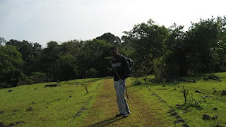
Here are few photos which I took out


Kalsubai mountain seen from Base village Bari

View of Bari village after climbing second ladder(Photo taken from Mobile phone)
The top most peak of Kalsubai(The highest point in Sahyadris)


Scene from top of the peak


Kalsubai Devi temple on top


View of Alang Madan and Kulang forts from top of Kalsubai


View of Bhandardara dam from Top of Kalsubai


Breath taking view of Sahyadris ,Alang and kulang forts from top of Kalsubai

View of Bhandardara dam,Ratangad and Ghanchakkar mountain to the far south


Side view of Kalsubai while proceeding to Ghoti and a view of Sahyadri ranges in background


View of Mahankal,Avandh and Patta forts to the far north seen from Bari village


Crystal clear and deep blue backwaters of Darna Dam while proceeding towards Ghoti(Again this photo taken from Mobile)


Wednesday, October 27, 2010

Sudhagad Trek

Dear Readers,
Posting my new trekking destination reached.
This post is related to Sudhagad Fort.It is situated 12 kms near Pali,one of the Asthavinayaka places in Maharastra
This place has two approaches to reach the top
1) From Nadsur-Dhondse: This is the easiest approach to reach the fort.Even an age old person can reach easily to the top.But this route is through dense forests and takes more than 3 hours
to reach the top plus there is no village after dhondase so if you have lost your way,it will be a really horrible situation.Prefer this road if any local guide is available from village.
2)From Pacchapur-Thakurwadi: This second route is tough one but easy to remember and very less chances of loosing your way.
From village Pali I collected information from people and came to conclusion that it will be better to follow the second route.Local people said that though the first route is easy to walk but if you loose your way,there will be no help available unless you are lucky enough.
Hence From Pali I got a ST bus to Thakurwadi around 8:45 to 9:00 am.It tool around 9:30 am to reach base village.Road is very narrow for around 5 kms(At some places,I had a doubt whether a car can pass through this road?) hence it takes too much time.But Hats off to our ST Mahamandal for running bus services in remotest parts.

Thakurwadi is a small village / hamlet of around 25 to 50 houses .People in this village are belonging to the Thakar Tribal community .Actually the name of village is 'Thakarwadi' but from British times,it was pronounced as Thakurwadi.
The bus halts near Zilla Parishad school and from the front of school,the road goes to Sudhagad fort through rice and Nachani fields,through the small huts the climb starts.
Height of Sudhagad is around 613 metres from Sea level and since Konkan is just around 50 to 100 metres from sea level,hence from ground,Sudhagad is around 550 metres plus climb from base village(almost the height of Sinhagad plus its tv tower )

From Thakurwadi,the gentle climb starts and almost after 100 meters climb,one can encounter steel ladders fixed in a rock.
After climbing the ladders,the climb starts becoming tough and the road leads towards deep forests.Now one has to be careful after climbing the ladders because this area becomes slippery and also somewhat steep through rocks.There are few steps carved in rock but be careful while climbing as well as while descending.
This steep climb takes around 1 hour in forests to reach the bastion walls(buruj in Marathi) . From here,there are blown up steps to take you till Pacchapur Darwaza .It is almost a rock climbing experience(Nothing to worry . Only look to the front while climbing and dont look down in the valley and everything will be alright)
From this Pacchapur Darwaza,the top of fort is around 1 more hour.Just follow the arrow marks drawn on the rock and you will reach the top.
The top of the fort is very very vast just like Raigad fort .It is almost 70 to 80 acres flat land(A small sports city can be built)
It takes around 2.5 hours to reach the top and around 4 hours to completely see the fort.
I reached the fort around 12:30 pm and there was a family of around 40 people from age group 10 years till 50 enjoying playing cricket and cooking food near the temple.

Top of the fort is very vast and from here,you can see Sahyadri mountains running parallel to Sudhagad,Mulshi Tamhini ghat mountains to the far East , To the North east,you can see huge rock walls of Telbaila Ghangad,and Salter and to the far north east one can see Koregad and mountains near Lonavla -Amby valley region. To the west,one can view Sarasgad fort situated near Pali temple and to far west you can have view of Tadgaon-unhere , Mahal Mira mountains and if weather is clear you can view Karnala fort to the far north west

After lot of walking on flat top,after reaching Bhorai temple,I decided to cook some food and as usual trekkers do,I cooked some khichadi but it took around more than 1 hours because it was difficult to burn fire due to strong wind.At last,I found a place behind temple where strong wind was getting obstructed and also few coconut coirs which burns very quickly and for longer time . And here,I cooked some khichadi at last.
After having some food,I just asked few persons from that family about the fort and few of them in the family who have not seen the fort completely agreed to come with me.They were people belonging to Pacchapur village and settled in Mumbai .
So we now moved to the Mahadarwaza which is situated in very very dense forests and joins the road coming from Dhondse .It is the exact replica of Mahadwar on Raigad
From here,We proceeded to the Takmak tok which is a point opens in a deep valley.The view was breathtaking and again from here we proceeded back and came towards Echo point.
Really echo works here I guess that Newton's third law works very well here and you get a very strong echo (and not like Mahabaleshwar echo point where we have to shout on top of voice to hear a bleak / feeble echo voice).
I was happy that even my voice generated an echo(It miserably failed at Mahabaleshwar echo point)
From here we came back to Bhorai temple to prepare and have some tea.
So after having tea around 3:30 -4:00 pm,we decided to move because we had to catch ST bus around 6:00 pm to Pali which was the last bus.
So again we proceeded to the return route.Here in dense trees is situated the wada/palace of Pant Sachiv of Bhor dynasty.This palace used to accomodate many people in olden days but now it is capable of accomodating around 50 people at a time.It is undergoing some construction now.
Also 10-20 people can stay in Bhorai temple.Also there are few people already staying on top.But related with food,You yourself have to make arrangements.

The return path was very very difficult at many places and was almost slippery hence we have to descend slowly.
After reaching the ladders and climbing down,the path was easier and around 5:45pm we reached Thakarwadi village and waited till 6:15 pm till the ST bus came and then again till 7:00 pm I was back at Pali And from here,I was back to Pune till 10:30 pm

Some brief about Sudhagad
Sudhagad was the capital of Bhor dynasty during British India and the kuldaivat of this dynasty Bhorai devi is situated here on top of the fort
During Shivaji Maharaj's rule also Sudhagad was shortlisted for the capital of Hindavi swaraj and According to suggestion of Naro Mukund,Shivaji Maharaj saw this fort but finally choose Raigad as his capital because of its central location

Routes to Sudhagad
From Pune it can be approached Via Khopoli-Pali-Thakurwadi
Pacchapur Fata is situated 9 kms before Pali on Tamhini/Bhira road.Take Left from here to reach the base village.
Further If you want to climb Sudhagad from Dhondse,From Pali,proceed to Tamhini/Bhira road and around 6 kms,take left to go to Nadsur and take right from Vaitakwadi to go to Dhondse village and from here you have to walk too much on the banks of river and start climb in deep forests.


ST buses
From Khopoli, first bus to pali leaves around 6:00 am and there are buses every hour
From Pali,first bus to Thakurwadi is around 7:15 am and next is around 8:45 to 9:00 am and the next is around 10:30 am.
The last return bus to Pali from Thakurwadi is around 6:00 am

For Nadsur/Dhondase route
Reach Pali till 10:00 am
at 10:25 am,there is a bus coming from Thane till Nadsur which reaches Nadsur at 11:00 am
This same bus leaves for Thane around 5:00 pm in evening

Possible Trekking combinations from This fort:
1) Descend Sudhagad from Mahadarwaza on the dhondse route ( Ask for Savashni ghat route or Bhairampada ) , climb Sahyadris to reach Telbaila walls and further towards Bhambarde,Base village of Ghanagad fort situated on west banks of Mulshi Dam and then proceed to Pune.
2) From above given route,till Telbeila, and from here proceed towards Salter and you can go towards Koregad and proceed towards Lonavala.
3) Descend Sudhagad from Mahadarwaza on the dhondse route and reach Nadsur village and from here you can walk to Thanale caves situated north of Sudhagad around 6 kms.From here you can proceed to Pali by coming back to Nadsur or you can proceed to Telbeila and follow routes given above.


Following are some photos with their descriptions


Nearby Pacchapur Darwaza after climbing half fort


View of Sahyadris and Mulshi Tamhini mountains while climbing Sudhagad


Thakurwadi and Pacchapur village seen while climbing Sudhagad


Telbaila walls and Salter seen from Top of Sudhagad.Koregad near Lonavla seen far behind


Ghanagad(in front) and Mulshi Tamhini(far away) mountains and the Sahyadri mountain ranges


Too much of flat space on top of the fort.Atleast 3 cricket grounds can fit in


Sudhagad Takmak tok seen from Tried and tested Echo point

Bhorai Devi Temple on top of the fort

Way towards Rajwada on Sudhagad


Wednesday, October 13, 2010

Nane Ghat

Dear Readers,
Heard a lot of things on Nane Ghat regarding the oldest trade route since 2500 years.I decided to see this place.
Nane ghat is situated on the edge of Sahyadris and was the trade route during the Satvahan era .It was octroi point where tax was collected from traders .There is one stone carved pot still existing and 2500 years back there were many such pots for collecting coins.
History: During satvahan era,Junnar and Pratisthan(Paithan) were amongst main towns of Satvahan kings.Mainly trade route that days was through Vasai port which used to get silk from Greece,Persia(through the olden silk route) and also other goods from Malay islands(Now Indonesia,Malayasia and other group of islands in that archipelago ) .So Vasai was the main port and from there,the goods were been transported through horsebacks to Paithan,Junnar and towns on Deccan pleateau(On this deccan pleateau,Satvahan kings ruled and their kingdom was till Amravati on banks of river krishna near Guntur).
So for business during olden days.this point was very important one.
This place is located near village Ghatghar 28 kms from Junnar(Not to be confused with one near Bhandardara).Basically villages near edge of ghats in sahyadris are called Ghatghar or kokanwadi in marathi.

From Junnar,there is motorable road from both the arms of Manikdoh dam.From the right arm also,there is a road to Nane Ghat but it is 42 kms good road with little bad patches on road, while a road going via Chavand,Kukdeshwar Aptale is 26 kms but a bad road patch for around 10 kms
so it takes around 1 hour to reach this place to reach flat plateau.
Naneghat hill is divided in three parts.A big plateau to right is called 'bhorande/bhorandachyedar' which is a descending route to Bhairavgad,Malshej ghat.
The center part is called as 'Naneghatachi Nali'.It is a road descending into konkan and to the left,there is a huge dyke lifted around 50 meters,forming a thumb like shape called 'Nanacha Angatha'.This is the highest point in Naneghat and from here,one can see the area of around 100 kms right from Bhimashankar-Ahupe,Siddhagad,Durg Dhakoba,Jivdhan till Harishchandragad-Kalsubai-Kulang in Sahyadris.Also one can view the Mahuli range near Asangaon-Kalyan if the environment is clear and also one can view Matheran-Haji Malang mountain ranges ofcourse if the weather is clear.
Hence this area was very important during any king's rule because this point served as watch towers over sahyadris especially during Chatrapati Shivaji Maharaj and during Peshwas rule.

Caves:
After descending 200 feets from Naneghatachi Nali,you reach the caves.There are numerous caves here(I am saying numerous because those caves are hard to locate so their exact figure cannot be sorted out because some of them are located at difficult locations)
There is one big cave which can accomodate around 50 persons and 3-4 smaller caves in the vicinity.
Inside the cave,there are some writings which are inscribed in Brahmi Lipi.Actually in pre-independence India,there were some statues carved in caves in praise of Raja Satakarni one of the Satvahan king under whom,the Satvahan dynasty flourished and kingdom expanded to a large extent.But unfortunately these statues were broken much before our Archeological survey of India noticed it.
For trekkers,there are numerous combinations
1) Visiting Jivdhan fort from Ghatghar and coming back at Naneghat to stay in cave and proceed through 'Bhorande dar' to Bhairavgad to Malshej
2) From Naneghat,descend down to Vaishakare/Tokawade and proceed to Dhasai for Dhakoba(Famous for its 900 meters straight and deep kokankada,the highest ever rock face exposure in sahyadris) or one can further proceed to Dehri for Gorakhgad and huge Siddhagad(One of the highest mountain from base village in Konkan)

Approach to Nane Ghat
1) Fune: Via Nasik Highway to Narayangaon ,take left about 1 km from Narayangaon and proceed on way to Junnar.From Junnar,there are two ways
a) Proceed on road to Amboli/Darya Ghat(Straight road from Junnar village Chowk) till Aptale and from here,take right for road going towards Chavand-Kukdeshwar till Ghatghar(somewhat bad road for 10 kms).Total distance is 26 kms till Naneghat
b) From Junnar Chowk.take right turn to the road to Lenyadri/Malshej and again around approx 1 km,take left turn on road going towards Manikdoh dam.This road is 42 kms till Nane ghat.
c) Another approach is to go straight on Nasik Highway till Alephata and take left for road going to Kalyan through Malshej Ghat.Descend Malshej Ghat to reach a point 2 kms before Vaishakare village called 'Nanetal' in Marathi which is the starting base for Naneghat in Konkan.From here,it takes 1.5 hours to reach the caves.

2)Via Kalyan
There are frequent buses going to Aurangabad,Nanded,Ahmednagar,Bid and Marathwada parts from Mumbai,hence there is no problem reaching this place from Kalyan and again going back to Mumbai/Kalyan

Bus frequencies
Route 1)From Shivajinagar,there are regular ST buses to Nasik.Reach Narayangaon and from here there are mini buses available every 15-20 minutes to Junnar.
From Junnar,there is a bus to Ghatghar around 9:30 to 10:00 am which reaches Ghatghar around 11:30 am.From here,Naneghat is 4 kms walk
Return bus from Ghatghar to Junnar is somewhere around 4:00 pm
Route 2)From Shivajinagar,there is first bus to Kalyan around 6:30-7:00 am which reaches NaneTal/Vaishakare around 11:00 pm.Actually NaneghatTal is not a ST stop hence you need to request to stop the bus at this point otherwise you have to get down at Vaishakare and come back 2 kms to this place.

Here are some photos

1) Naneghatachi Nali


2) Naneghat from Ghatghar


3) Naneghat Cave


4) From Top of Naneghat during rainy season

Tuesday, May 4, 2010

Ratangad Bhandardara Trek

Bhandardara and Ratangad Trek:

Sahyadris fascinates trekkers very much and the Bhandardara region is full of huge mountains which is a paradise for trekkers.
Average height for mountains in this area is around 1400 meters.Kalsubai,the highest peak in Maharashtra comes under this region.
You have a big dam in this area,the Wilson lake or Bhandardara lake near Shendi village.
As a trekker,I just thought to visit Bhandardara and then decide where to go(Either Kalsubai or Ratangad.Actually I wanted to go both places but due to time restrictions,anyway there is always a next time).
I arrived at Bhandardara morning around 10:30 am on my bike from Pune.It was a 4 hr Drive via Nasik Highway - Ale Phata - Malshej road - Otur -Bramhanwada - kotul - Akole - Rajur , but it was saturday 1st May 2010 and due to 2 days holidays,I didnt get bookings at any resort at Bhandardara even though I was trying from 10 days.Hence I decided that I will reach this place and search for accomodation.Also tents were not available.
It was 11:00 am now and I was just walking through shores of the lake.due to summer season,this lake was almost dry.
After talking to few people in Bhandardara,I just made up my mind to go to either Ratangad or Kalsubai.I also heard of Konkan-Kada near Ghatghar some 23 kms away from Bhandardara,hence I decided to go there first then come back to Bhandardara.
The road to Ghatghar was full of dust,zig-zag turns,through dense forests(Actually there is a reserved forest between Harishchandragad to Kalsubai area and backwaters of Bhandardara falls under this region).In almost 45 minutes,I reached Ghatghar dam,

From here there was a somewhat motorable road through dense forests about 2 kms where there is the konkan-kada point.
Apart from the dam and one house and one small garden near the konkankada point,there was absoloutely no person living in that village in dense forests.
It was a good view from that kokankada.Concave rock of about 1000 feet straightway into konkan area.From the top one can see the sakurdi ghat area which is a route for trekkers to descend into konkan towards Kalyan.Also there is a Chor Nali(Secret pass) which descends from Samrad to Dehne,the base village of Ajoba Hill.But for this,one needs to climb down the huge rocks.
After that,I again came towards the Dam and while I reached Samrad,I saw a board showing Ratanwadi 28 kms towards right.I have heard much of the Ratanwadi Amruteshwar temple,hence I decided to go to this place first and then go back to Bhandardara
The scenes were terrific.On my left,I could see Kulang,Madangad,Alang and Kalsubai,backwaters of Bhandardara dam and on my right,I could see the Pinnacle of Ratangad,Katrabai,Ajoba and Ghanchakkar,Muda,Pabargad mountains.
The road was not that good,hence within a hour nearby 2:30 pm,I reached the base village Ratanwadi.
It is a village with around 30-40 houses,and a ancient temple of lord Shiva called as Amruteshwar temple.It is believed that this temple is 1500 years old.This temple is marvellous with carvings in rock is excellent.Its structure is similiar to the temples of Vijaynagar.
After having food ,I asked a local villager nearby temple for accomodation and he readily invited me to stay at his place.
It was around 4:00 pm now and I just decided to continue to Ratangad and stay there overnight in a cave and return back next afternoon and proceed to pune,but it started raining when I was about to climb the hill.
Hence I came back and decided to start early morning next day.
I also met a group of trekkers who climbed down ratangad.after talking to them,I came to know that a local guide is necesscary because there are lot of confusing paths while climbing.Hence I talked to a local person and he agreed to come with me early morning around 5:30 am.
Till than i didnt have any work hence,I continued in the village trying to learn better photography with my camera :)
The sunset seen from Ratanwadi village was beautiful.
I had temple in front,with Ratangad fort in background and I was able to see a needle hole on top of the fort through which,the sun rays were coming out and It was looking like a diamond ring(I thought that may be due to this this fort might be named as Ratangad)
I had a stay near Ratanwadi temple and was waiting for morning
As decided,at morning 6:00 am,the guide arrived and I met one more trekker in the village.
So we started our trek.
We just started through the road adjoining Pravara river,Very soon after 1 kilometer, the dense forest started and after crossing the dry river bed,we entered the forest and steep climbings started.
Very soon in half hour,I was able to see the sunrise behind the Kalsubai mountain and shining backwaters of Bhandardara lake with lush grenery all around(I was not able to believe that it was month of may).
Further the climbing became more and more steep and we started to enter dense forests and now,It was sweating a lot and we reached a point where a road among forests go towards Harishchandragad(6 hours walking distance from this point).
This point is most confusing one especially if you are new in this region,hence I dont regret the decission to hire a local guide because I might have confused by the road and would have went somewhere.
From this confusing point,take a right turn and again a steep climb starts and within 15-20 minutes one can reach the ladders of fort.
These ladders are fixed in the rock and after climbing the rock,you reach the Hanuman Darwaza and next ladder takes you to Ganesh Darwaza and from here,you reach the top of the fort.
After reaching the fort,I was speechless.The scene which I saw,I didnt move from that place till 15-20 minutes.
It took total 2 hours to reach the top.
After reaching the top,I saw the huge rock walls to Konkan.These rocks were around 2000 to 3000 feet in height from ground.In your front you see Katrabai and Ajoba mountain with huge rock walls and scissor like sharp rocks of katrabai(Katri in Marathi means scissor)
To South you can see Ajoba and katrabai mountains,To your East you can view Muda and Ghanchakkar mountains and to your north you see huge Kalsubai,Alang Kulang and sharp rocks of Madangad and backwaters of Bhandardara lake and towards west,huge walls of Ratangad falling towards Konkan.These rock walls are almost 2000 feet and straight.
After this breathtaking view,we moved further to take rest in a cave.
The cave is big enough that it can accomodate around 20 persons very easily.Also there is a water tank but not drinkable water in summer(So if you want to stay in cave,Atleast 4 liters water per person is needed).
The reason for not drinkable is because many fellow trekkers wash their utensils by dipping directly in the tank,throw plastic cups and cans,hence a good source of water is completely spoiled now.This thing makes me angry when a good source of water is spoiled.
After spending some time near caves,we decided to descend Ratangad and come back to Ratanwadi.But We decided to descend from the Konkan side through a chimney shaped rock having steep steps.
The steps were almost 80 degrees in the rocks and straight into the valley.It was frightening one.If by mistake if you slip,you will be in the valley within a flash.Very carefully we descended the rock of around 600 - 800 feets and we proceeded towards the pinnacle of Ratangad.
Again the road towards the pinnacle was frightening one.
To your left there is a valley of around 3000 feet with a straight wall and a very small road on the side of wall going towards pinnacle.It was a frightening scene.You have to walk aside the rock wall for around 500 meters so one has to be very very careful here.Please dont prefer this route in rainy season unless you dont have expertize. or fair amount of practice in trekking.
It took 2.5 hours to descend to Ratanwadi from that pinnacle.We were almost dehydrated due to the heat.
Around 12:30,We reached Ratanwadi.
Maybe next time I would think of going to Kalsubai.
Around 3:00 pm I left for Pune.Again there was pre monsoonal rain nearby Alephata,hence I stopped there for 2 hours.Again after the rain was over,I started to go towards pune and reached around 10:00 pm.
Very interesting Biking trip and a good trek to Ratangad I had

Pankaj
9420723476

Some photos I have uploaded


1) Way to Konkankada from Bhandardara Behind Kalsubai.


2) From Ghatghar Kokankada


3) Ghatghar Dam (Madangad and Alang seen behind)


4) Ajoba and katrabai mountains from Samrad Village


5) Kalsubai mountain seen on the way to Ratanwadi


6) KulangGad ,Madangad and Alang Gad seen from Ghatghar (From Left to right)


7) Ratanwadi Amruteshwar Temple


8) Sunset at Ratanwadi(Needle hole of Ratangad seen clearly in the top of fort)


9) Sunrise on way to Ratangad


10) Reaching the Ladders of Ratangad Fort


11) Entrance to Ratangad Fort


12) Konkan side scene from top of Ratangad.Straight rocks of around 3000 feets of Katrabai and Ajoba


13 ) Katrabai Dongar(Scissior like sharp rocks seen)


14) Huge rock of Katrabai connecting Ajoba and Ghanchakkar,Mutkhel mountains.From this mountain,there is a 6 hours walking route to Harishchandragad


15 ) Mighty Ajoba Dongar famous for Samadhi of Valmiki Rishi and Birth place of Lav and Kush in Ramayana


16 ) Descending down from steps carved inside rocks which are around 80 degrees straight into 4000 feets valley


17) Ratangad Pinnacle


From this Pinnacle,we took right turn and descended to Ratanwadi village