Dear Readers,
Posting my new trekking destination reached.
This post is related to Sudhagad Fort.It is situated 12 kms near Pali,one of the Asthavinayaka places in Maharastra
This place has two approaches to reach the top
1) From Nadsur-Dhondse: This is the easiest approach to reach the fort.Even an age old person can reach easily to the top.But this route is through dense forests and takes more than 3 hours
to reach the top plus there is no village after dhondase so if you have lost your way,it will be a really horrible situation.Prefer this road if any local guide is available from village.
2)From Pacchapur-Thakurwadi: This second route is tough one but easy to remember and very less chances of loosing your way.
From village Pali I collected information from people and came to conclusion that it will be better to follow the second route.Local people said that though the first route is easy to walk but if you loose your way,there will be no help available unless you are lucky enough.
Hence From Pali I got a ST bus to Thakurwadi around 8:45 to 9:00 am.It tool around 9:30 am to reach base village.Road is very narrow for around 5 kms(At some places,I had a doubt whether a car can pass through this road?) hence it takes too much time.But Hats off to our ST Mahamandal for running bus services in remotest parts.
Thakurwadi is a small village / hamlet of around 25 to 50 houses .People in this village are belonging to the Thakar Tribal community .Actually the name of village is 'Thakarwadi' but from British times,it was pronounced as Thakurwadi.
The bus halts near Zilla Parishad school and from the front of school,the road goes to Sudhagad fort through rice and Nachani fields,through the small huts the climb starts.
Height of Sudhagad is around 613 metres from Sea level and since Konkan is just around 50 to 100 metres from sea level,hence from ground,Sudhagad is around 550 metres plus climb from base village(almost the height of Sinhagad plus its tv tower )
From Thakurwadi,the gentle climb starts and almost after 100 meters climb,one can encounter steel ladders fixed in a rock.
After climbing the ladders,the climb starts becoming tough and the road leads towards deep forests.Now one has to be careful after climbing the ladders because this area becomes slippery and also somewhat steep through rocks.There are few steps carved in rock but be careful while climbing as well as while descending.
This steep climb takes around 1 hour in forests to reach the bastion walls(buruj in Marathi) . From here,there are blown up steps to take you till Pacchapur Darwaza .It is almost a rock climbing experience(Nothing to worry . Only look to the front while climbing and dont look down in the valley and everything will be alright)
From this Pacchapur Darwaza,the top of fort is around 1 more hour.Just follow the arrow marks drawn on the rock and you will reach the top.
The top of the fort is very very vast just like Raigad fort .It is almost 70 to 80 acres flat land(A small sports city can be built)
It takes around 2.5 hours to reach the top and around 4 hours to completely see the fort.
I reached the fort around 12:30 pm and there was a family of around 40 people from age group 10 years till 50 enjoying playing cricket and cooking food near the temple.
Top of the fort is very vast and from here,you can see Sahyadri mountains running parallel to Sudhagad,Mulshi Tamhini ghat mountains to the far East , To the North east,you can see huge rock walls of Telbaila Ghangad,and Salter and to the far north east one can see Koregad and mountains near Lonavla -Amby valley region. To the west,one can view Sarasgad fort situated near Pali temple and to far west you can have view of Tadgaon-unhere , Mahal Mira mountains and if weather is clear you can view Karnala fort to the far north west
After lot of walking on flat top,after reaching Bhorai temple,I decided to cook some food and as usual trekkers do,I cooked some khichadi but it took around more than 1 hours because it was difficult to burn fire due to strong wind.At last,I found a place behind temple where strong wind was getting obstructed and also few coconut coirs which burns very quickly and for longer time . And here,I cooked some khichadi at last.
After having some food,I just asked few persons from that family about the fort and few of them in the family who have not seen the fort completely agreed to come with me.They were people belonging to Pacchapur village and settled in Mumbai .
So we now moved to the Mahadarwaza which is situated in very very dense forests and joins the road coming from Dhondse .It is the exact replica of Mahadwar on Raigad
From here,We proceeded to the Takmak tok which is a point opens in a deep valley.The view was breathtaking and again from here we proceeded back and came towards Echo point.
Really echo works here I guess that Newton's third law works very well here and you get a very strong echo (and not like Mahabaleshwar echo point where we have to shout on top of voice to hear a bleak / feeble echo voice).
I was happy that even my voice generated an echo(It miserably failed at Mahabaleshwar echo point)
From here we came back to Bhorai temple to prepare and have some tea.
So after having tea around 3:30 -4:00 pm,we decided to move because we had to catch ST bus around 6:00 pm to Pali which was the last bus.
So again we proceeded to the return route.Here in dense trees is situated the wada/palace of Pant Sachiv of Bhor dynasty.This palace used to accomodate many people in olden days but now it is capable of accomodating around 50 people at a time.It is undergoing some construction now.
Also 10-20 people can stay in Bhorai temple.Also there are few people already staying on top.But related with food,You yourself have to make arrangements.
The return path was very very difficult at many places and was almost slippery hence we have to descend slowly.
After reaching the ladders and climbing down,the path was easier and around 5:45pm we reached Thakarwadi village and waited till 6:15 pm till the ST bus came and then again till 7:00 pm I was back at Pali And from here,I was back to Pune till 10:30 pm
Some brief about Sudhagad
Sudhagad was the capital of Bhor dynasty during British India and the kuldaivat of this dynasty Bhorai devi is situated here on top of the fort
During Shivaji Maharaj's rule also Sudhagad was shortlisted for the capital of Hindavi swaraj and According to suggestion of Naro Mukund,Shivaji Maharaj saw this fort but finally choose Raigad as his capital because of its central location
Routes to Sudhagad
From Pune it can be approached Via Khopoli-Pali-Thakurwadi
Pacchapur Fata is situated 9 kms before Pali on Tamhini/Bhira road.Take Left from here to reach the base village.
Further If you want to climb Sudhagad from Dhondse,From Pali,proceed to Tamhini/Bhira road and around 6 kms,take left to go to Nadsur and take right from Vaitakwadi to go to Dhondse village and from here you have to walk too much on the banks of river and start climb in deep forests.
ST buses
From Khopoli, first bus to pali leaves around 6:00 am and there are buses every hour
From Pali,first bus to Thakurwadi is around 7:15 am and next is around 8:45 to 9:00 am and the next is around 10:30 am.
The last return bus to Pali from Thakurwadi is around 6:00 am
For Nadsur/Dhondase route
Reach Pali till 10:00 am
at 10:25 am,there is a bus coming from Thane till Nadsur which reaches Nadsur at 11:00 am
This same bus leaves for Thane around 5:00 pm in evening
Possible Trekking combinations from This fort:
1) Descend Sudhagad from Mahadarwaza on the dhondse route ( Ask for Savashni ghat route or Bhairampada ) , climb Sahyadris to reach Telbaila walls and further towards Bhambarde,Base village of Ghanagad fort situated on west banks of Mulshi Dam and then proceed to Pune.
2) From above given route,till Telbeila, and from here proceed towards Salter and you can go towards Koregad and proceed towards Lonavala.
3) Descend Sudhagad from Mahadarwaza on the dhondse route and reach Nadsur village and from here you can walk to Thanale caves situated north of Sudhagad around 6 kms.From here you can proceed to Pali by coming back to Nadsur or you can proceed to Telbeila and follow routes given above.
Following are some photos with their descriptions
Nearby Pacchapur Darwaza after climbing half fort

View of Sahyadris and Mulshi Tamhini mountains while climbing Sudhagad

Thakurwadi and Pacchapur village seen while climbing Sudhagad

Telbaila walls and Salter seen from Top of Sudhagad.Koregad near Lonavla seen far behind

Ghanagad(in front) and Mulshi Tamhini(far away) mountains and the Sahyadri mountain ranges

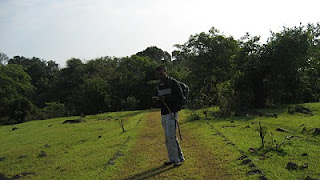
Too much of flat space on top of the fort.Atleast 3 cricket grounds can fit in

Sudhagad Takmak tok seen from Tried and tested Echo point

Bhorai Devi Temple on top of the fort

Way towards Rajwada on Sudhagad
Thanks a lot , information is very useful
ReplyDelete